S'COOL: Cumulus Clouds

Cirrus over Cumulus
This is a nice multi-layer tropical cloud situation, with low cumulus and high cirrus clouds both present. Photo taken by Doug Stoddard in March 2002, in Puerto Rico.
This is a nice multi-layer tropical cloud situation, with low cumulus and high cirrus clouds both present. Photo taken by Doug Stoddard in March 2002, in Puerto Rico.
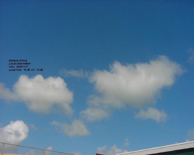
Cumulus
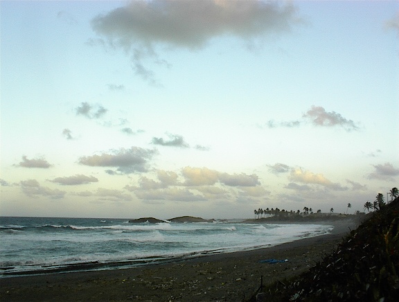
This is a partly cloudy cumulus scene, with the cloud base quite low, as might be typical on a humid day. Photo from Radians School in Puerto Rico.
This is a partly cloudy cumulus scene, with the cloud base quite low, as might be typical on a humid day. Photo from Radians School in Puerto Rico.
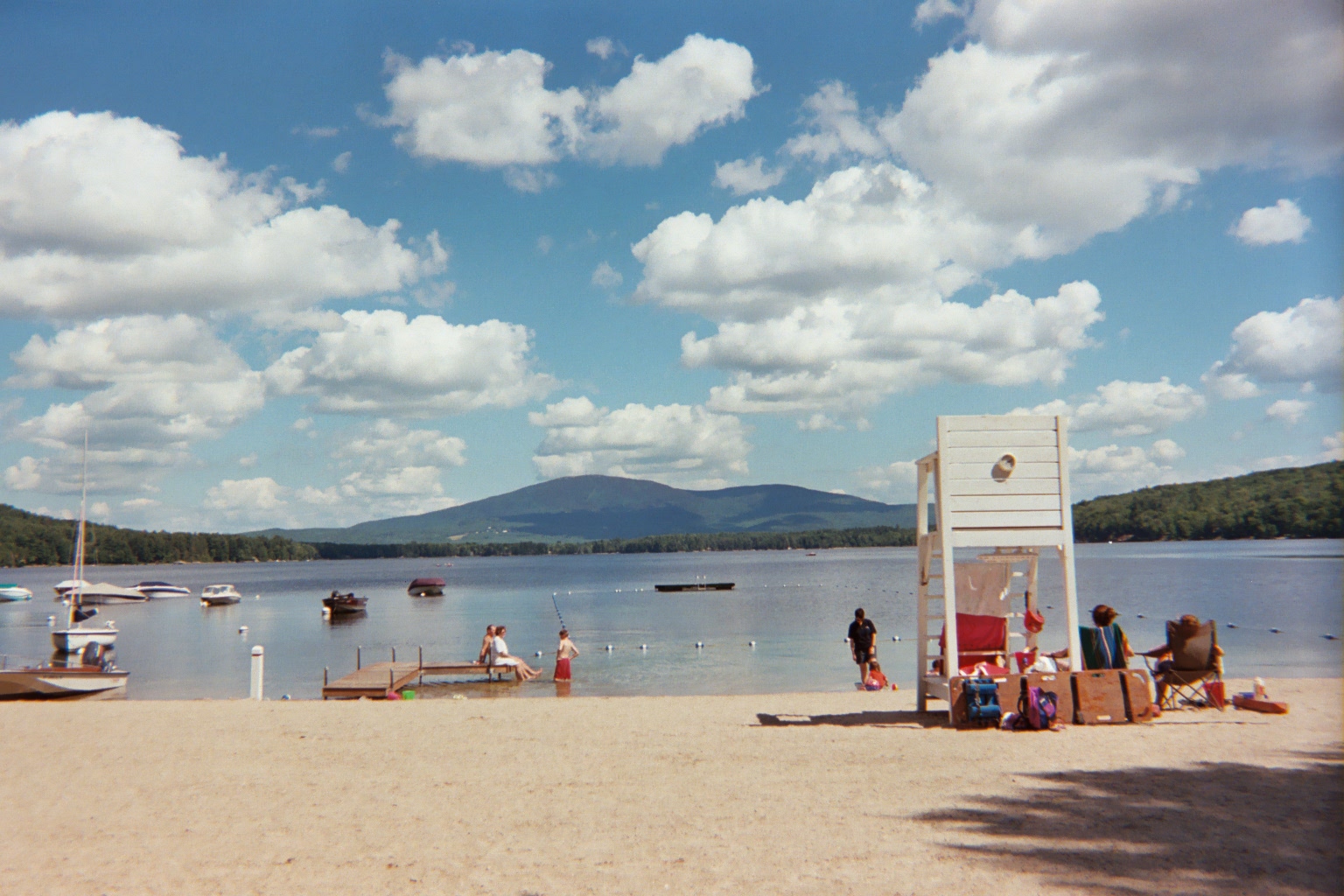
Fair Weather Cumulus
This is a fair weather cumulus scene over Pleasant Lake in New Hampshire. It is typical of summertime in the northern United States. Note that the cloud base is relatively high, as indicated by the fact that the clouds are higher than Mount Kearsarge (elev. 996 m; 753 m above the lake). Photo by Lin Chambers, July 2003.
This is a fair weather cumulus scene over Pleasant Lake in New Hampshire. It is typical of summertime in the northern United States. Note that the cloud base is relatively high, as indicated by the fact that the clouds are higher than Mount Kearsarge (elev. 996 m; 753 m above the lake). Photo by Lin Chambers, July 2003.
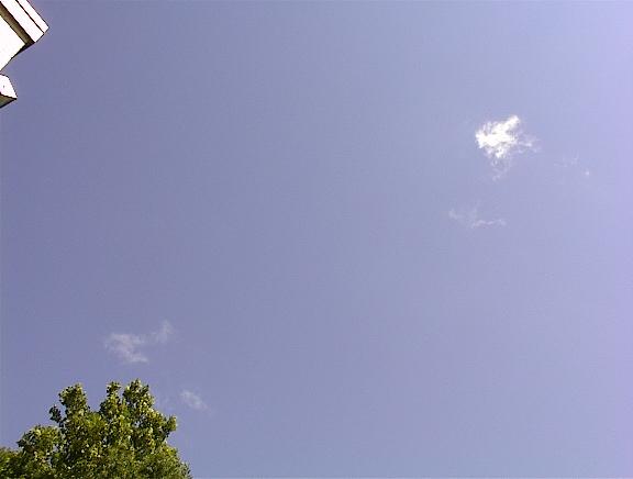
Forming or Dissipating Cumulus
This is an example of a cumulus cloud as it is just beginning to form, or as it has mostly evaporated (a time sequence would be necessary to figure out which one). Be careful not to misclassify such wispy, isolated cumulus as some other cloud type. Look for other clues like other clouds that might be in the same layer, direction and speed of movement with the wind, etc. Photo by Lin Chambers in southeastern Virginia.
This is an example of a cumulus cloud as it is just beginning to form, or as it has mostly evaporated (a time sequence would be necessary to figure out which one). Be careful not to misclassify such wispy, isolated cumulus as some other cloud type. Look for other clues like other clouds that might be in the same layer, direction and speed of movement with the wind, etc. Photo by Lin Chambers in southeastern Virginia.
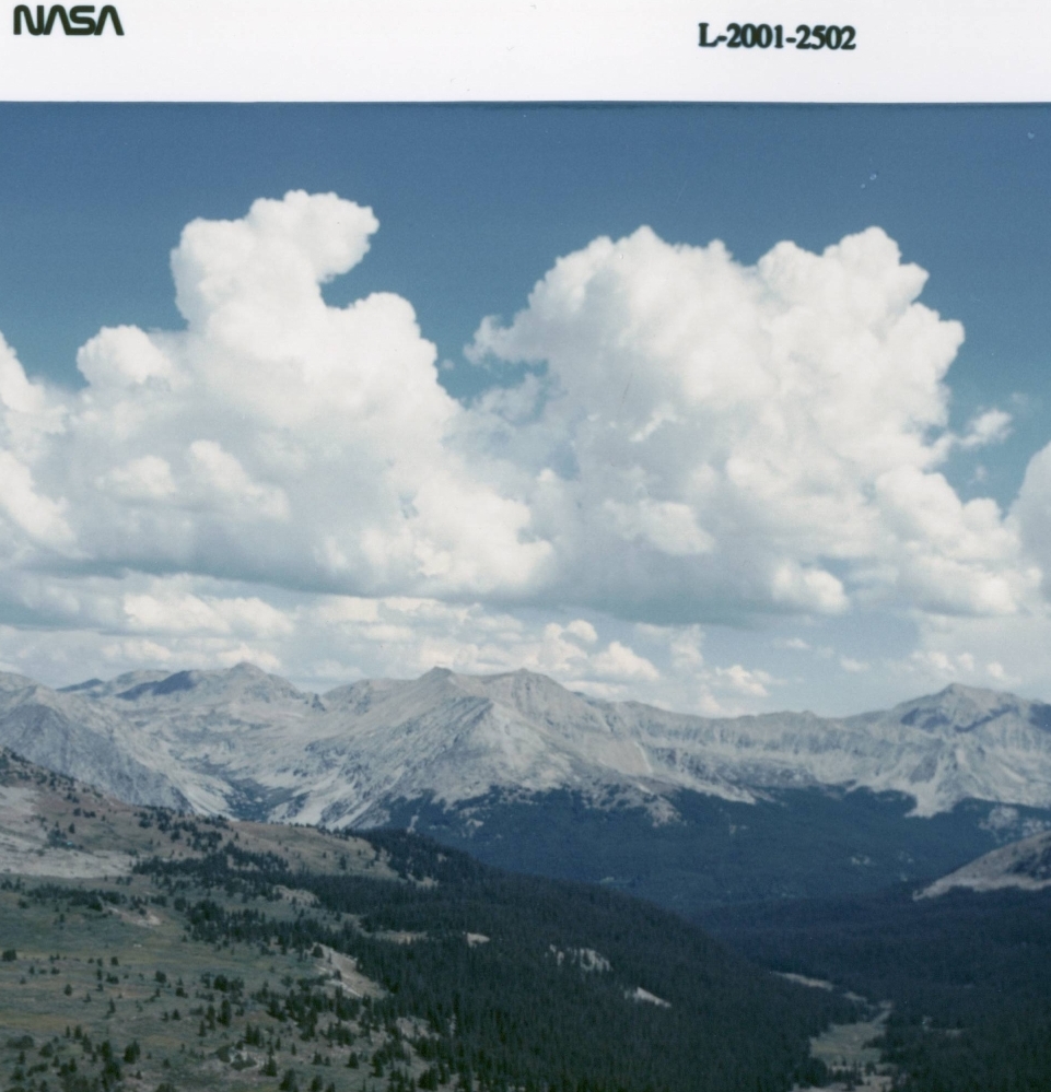
Cumulus over the Rocky Mountains
These cumulus clouds are a good example of the sort of definite shape that is typical of these clouds. Children (of all ages!) can look for familiar shapes in them. Note that, even though these clouds are above the Rocky Mountains, they are still classified as low level clouds because they are not very far above the local ground surface. Photo by Jeff Caplan, NASA photographer, during a flight testing experiment in the Rocky Mountains, August, 2001.
These cumulus clouds are a good example of the sort of definite shape that is typical of these clouds. Children (of all ages!) can look for familiar shapes in them. Note that, even though these clouds are above the Rocky Mountains, they are still classified as low level clouds because they are not very far above the local ground surface. Photo by Jeff Caplan, NASA photographer, during a flight testing experiment in the Rocky Mountains, August, 2001.
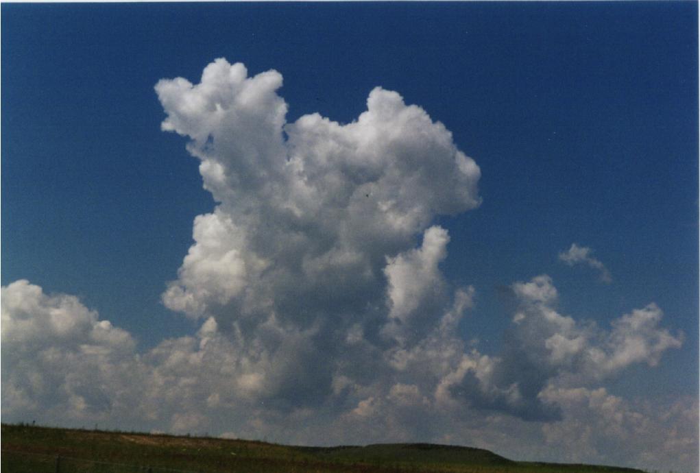
Cumulus Congestus
How many cartoon characters can you find in this classic cumulus cloud? Congestus denotes a cloud with active vertical development. Another photo 10-15 minutes later would show a cloud with a very different shape. Photo by Kevin Larman in Colorado.
How many cartoon characters can you find in this classic cumulus cloud? Congestus denotes a cloud with active vertical development. Another photo 10-15 minutes later would show a cloud with a very different shape. Photo by Kevin Larman in Colorado.
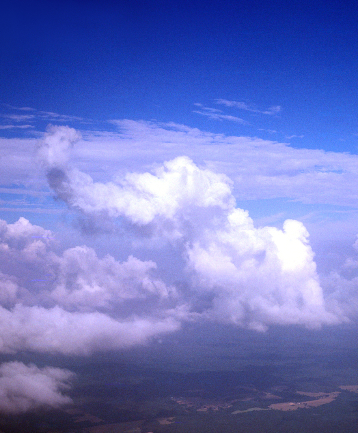
Elephant Cumulus
Cloud type is cumulus congestus: these are clouds that are more strongly developed than fair weather cumulus and may become thunderstorms later in the day if the atmosphere is sufficiently unstable. Photo taken with a Canon SLR from an aircraft by Dr. Bruce Wielicki, CERES Principal Investigator, in the late 1970s.
Cloud type is cumulus congestus: these are clouds that are more strongly developed than fair weather cumulus and may become thunderstorms later in the day if the atmosphere is sufficiently unstable. Photo taken with a Canon SLR from an aircraft by Dr. Bruce Wielicki, CERES Principal Investigator, in the late 1970s.
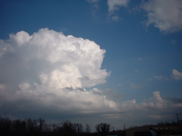
Cumulus Congestus
A classic convective cloud towering over its neighbors. Under the right conditions, this cloud will grow into a cumulonimbus cloud - a thunderstorm. Photo by Ed Donovan of Berry Shoals Intermediate School, January 28th, 2002 in South Carolina.
A classic convective cloud towering over its neighbors. Under the right conditions, this cloud will grow into a cumulonimbus cloud - a thunderstorm. Photo by Ed Donovan of Berry Shoals Intermediate School, January 28th, 2002 in South Carolina.
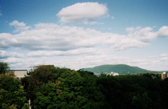
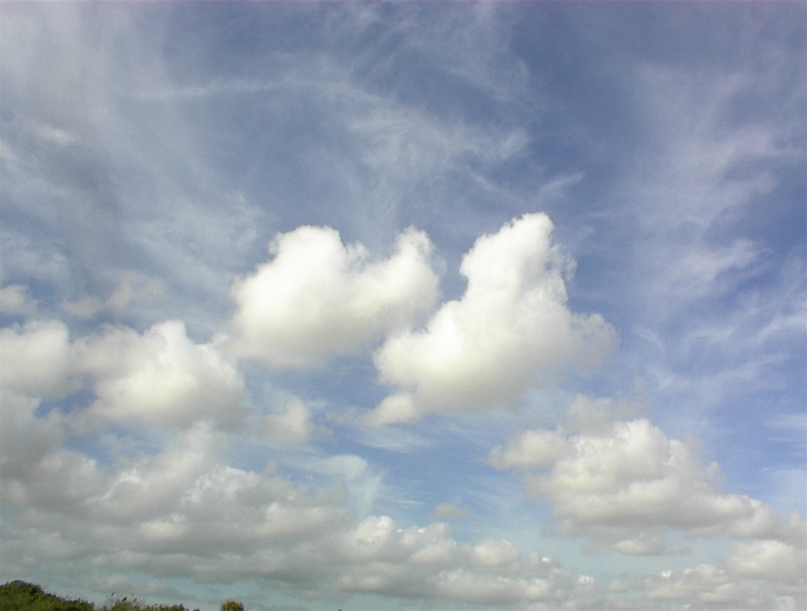
Cumulus Humilis
These are much more modest cumulus clouds, but cumulus clouds nonetheless. This photo was taken by Mandy Khaiyer form Pennsylvania State University, an area of low mountains. Looking at the regular structure of cloudiness, it is likely that these clouds are formed in waves of air moving up and down off the nearby mountains. Clouds form where the air moves up and cools to the point of water condensation. Such clouds do not show the vertical development typical of convective cumulus as above.
These are much more modest cumulus clouds, but cumulus clouds nonetheless. This photo was taken by Mandy Khaiyer form Pennsylvania State University, an area of low mountains. Looking at the regular structure of cloudiness, it is likely that these clouds are formed in waves of air moving up and down off the nearby mountains. Clouds form where the air moves up and cools to the point of water condensation. Such clouds do not show the vertical development typical of convective cumulus as above.
Trade Cumulus
This is a beautiful example of trade cumulus (i.e., cumulus associated with the tradewinds) in the Tropics. Note how the clouds in the far field seem very defined, while the nearby cloud (top of photo) appears much more diffuse. This is simply a matter of distance and perspective. All these clouds are in the same low layer of cumulus. Photo taken by Doug Stoddard, March 7, 2002 on the north coast of Puerto Rico, looking towards the east.
This is a beautiful example of trade cumulus (i.e., cumulus associated with the tradewinds) in the Tropics. Note how the clouds in the far field seem very defined, while the nearby cloud (top of photo) appears much more diffuse. This is simply a matter of distance and perspective. All these clouds are in the same low layer of cumulus. Photo taken by Doug Stoddard, March 7, 2002 on the north coast of Puerto Rico, looking towards the east.
Cirrus over Cumulus
This is a great, fairly typical shot of high thin cirrus over low cumulus clouds in the Tropics. Photo taken by Doug Stoddard in March 2002, in Puerto Rico
This is a great, fairly typical shot of high thin cirrus over low cumulus clouds in the Tropics. Photo taken by Doug Stoddard in March 2002, in Puerto Rico
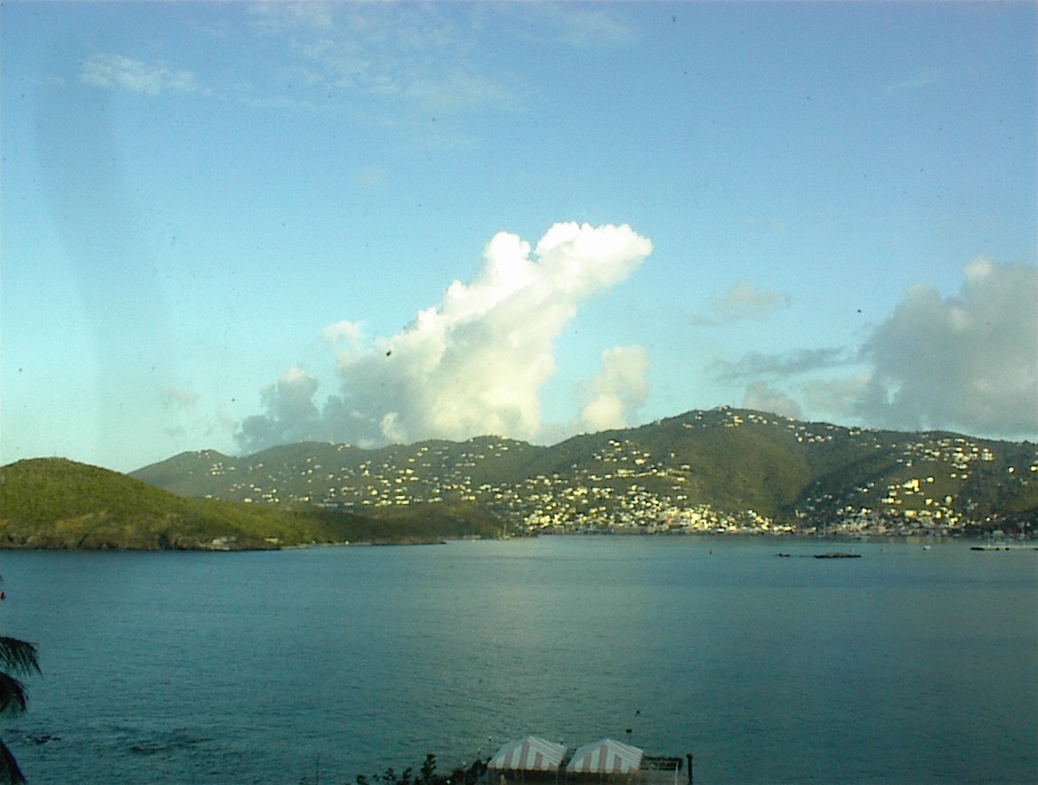
Cumulus Congestus
This is an impressive shot of cumulus congestus, most likely caused by convection over the island. It may be due to surface heating, but it might also be from orographic lifting by the mountians. Photo taken by Doug Stoddard in March 2002, in Puerto Rico.
This is an impressive shot of cumulus congestus, most likely caused by convection over the island. It may be due to surface heating, but it might also be from orographic lifting by the mountians. Photo taken by Doug Stoddard in March 2002, in Puerto Rico.
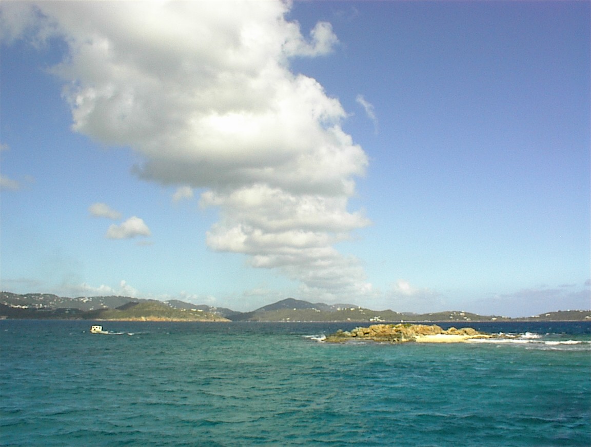
Cumulus
Here is a great shot showing a line of cumulus clouds, most likely formed because of the presence of the island. Photo taken by Doug Stoddard in March 2002, in Puerto Rico.
Here is a great shot showing a line of cumulus clouds, most likely formed because of the presence of the island. Photo taken by Doug Stoddard in March 2002, in Puerto Rico.

Opaque Cumulus
This is a neat one: note that despite their wispy appearance, these clouds are casting a strong shadow on the island. This indicates they are fairly opaque cumulus; not wispy cirrus which might be one's first guess. Photo taken by Doug Stoddard on March 2002, in Puerto Rico.
This is a neat one: note that despite their wispy appearance, these clouds are casting a strong shadow on the island. This indicates they are fairly opaque cumulus; not wispy cirrus which might be one's first guess. Photo taken by Doug Stoddard on March 2002, in Puerto Rico.