Cumulonimbus Clouds
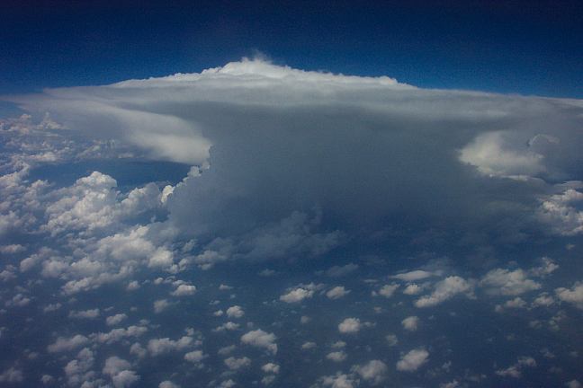
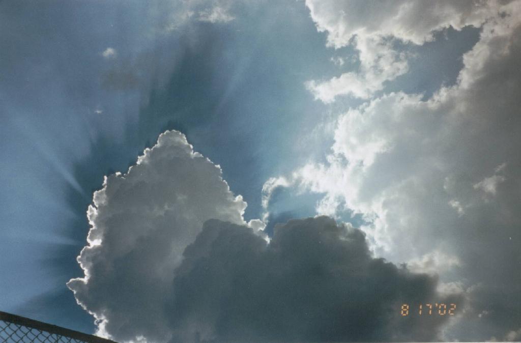
Side View of Cumulonimbus Anvil
This striking photograph was taken from an airplane window - good thing they decided to go around! It shows the classic "anvil" shape that a thunderstorm takes. This shape arises from the lifting of air in the cloud right up to the tropopause, at which point it cannot rise any more and spreads into the anvil.
Photo by Terry O'Leary, Virginia Beach, VA, USA. Taken early summer 2003 over Central VA.
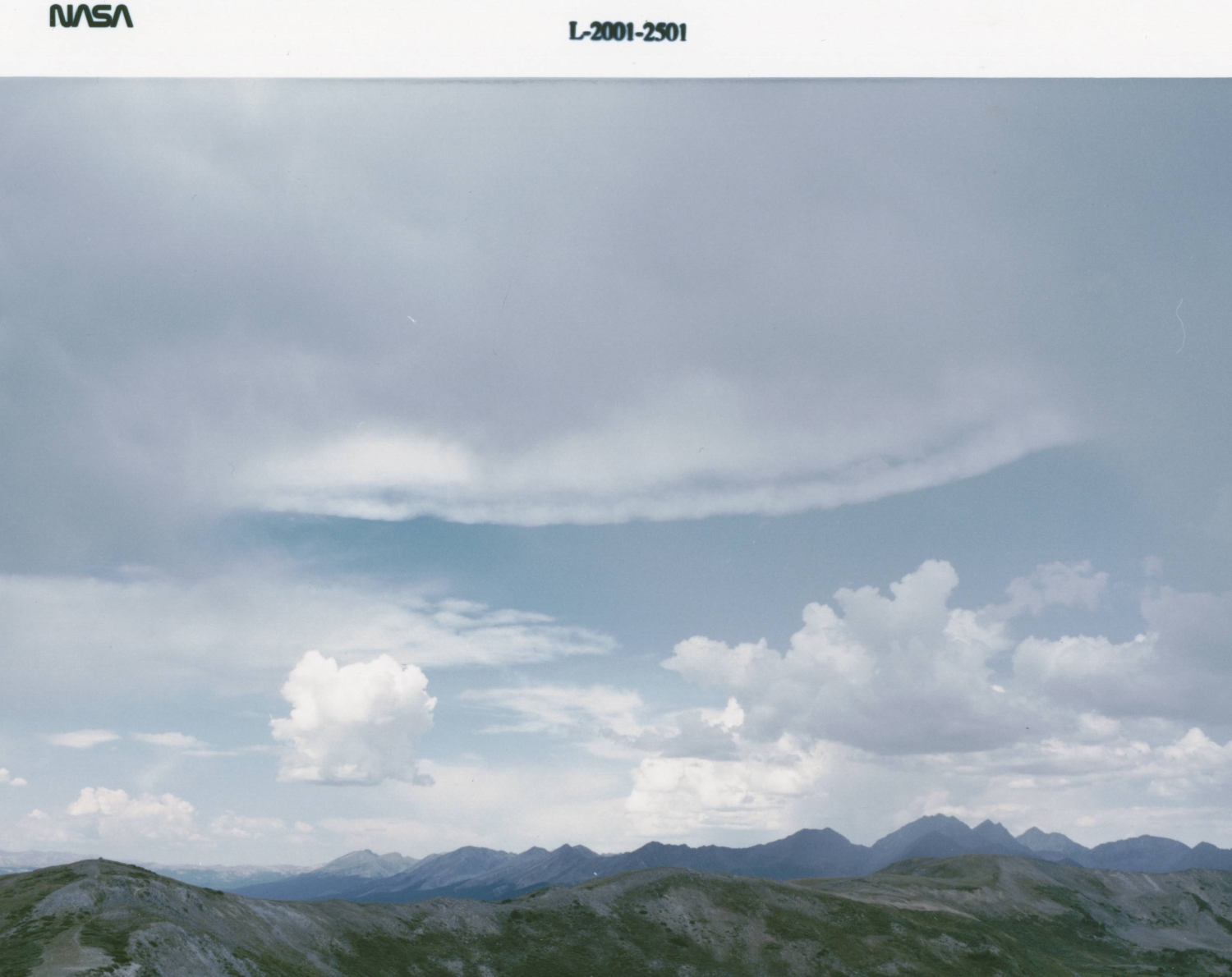
Thunderstorm over the Rocky Mountains
The fan-shaped cloud in the center of this picture is the edge of a cumulonimbus anvil visible through lower level cumulus clouds. This is a fairly common sight out West, but is rarely seen in the East due to the fact that the very moist atmosphere around a thunderstorm often obscures any detail of the clouds. Photo by Jeff Caplan, NASA photographer, during a flight testing experiment in the Rocky Mountains, August, 2001.
The fan-shaped cloud in the center of this picture is the edge of a cumulonimbus anvil visible through lower level cumulus clouds. This is a fairly common sight out West, but is rarely seen in the East due to the fact that the very moist atmosphere around a thunderstorm often obscures any detail of the clouds. Photo by Jeff Caplan, NASA photographer, during a flight testing experiment in the Rocky Mountains, August, 2001.
Billowing Cumulonimbus
This photo of a billowing cumulus cloud came from the GLOBE program. This is clearly an opaque (very thick) cloud. Cloud cover is hard to determine from this single view, but is probably partly to mostly cloudy.
This photo of a billowing cumulus cloud came from the GLOBE program. This is clearly an opaque (very thick) cloud. Cloud cover is hard to determine from this single view, but is probably partly to mostly cloudy.
Thunderstorm
This wide-angle photograph shows an intense early evening (about 6:15 pm) thunderstorm over Virginia Beach as observed from Poquoson, Virginia (a distance of about 25 miles or 40 km). The weather earlier in the day had been unsettled due to the passage of a cold front; however, the appearance of the thunderstorm was surprising since the sky conditions were mostly clear in Poquoson.
The photographer was alerted to the presence of this thunderstorm during the broadcast of the local weather report when radar images indicated intense rainfall over Virginia Beach. Photo by David Kratz.
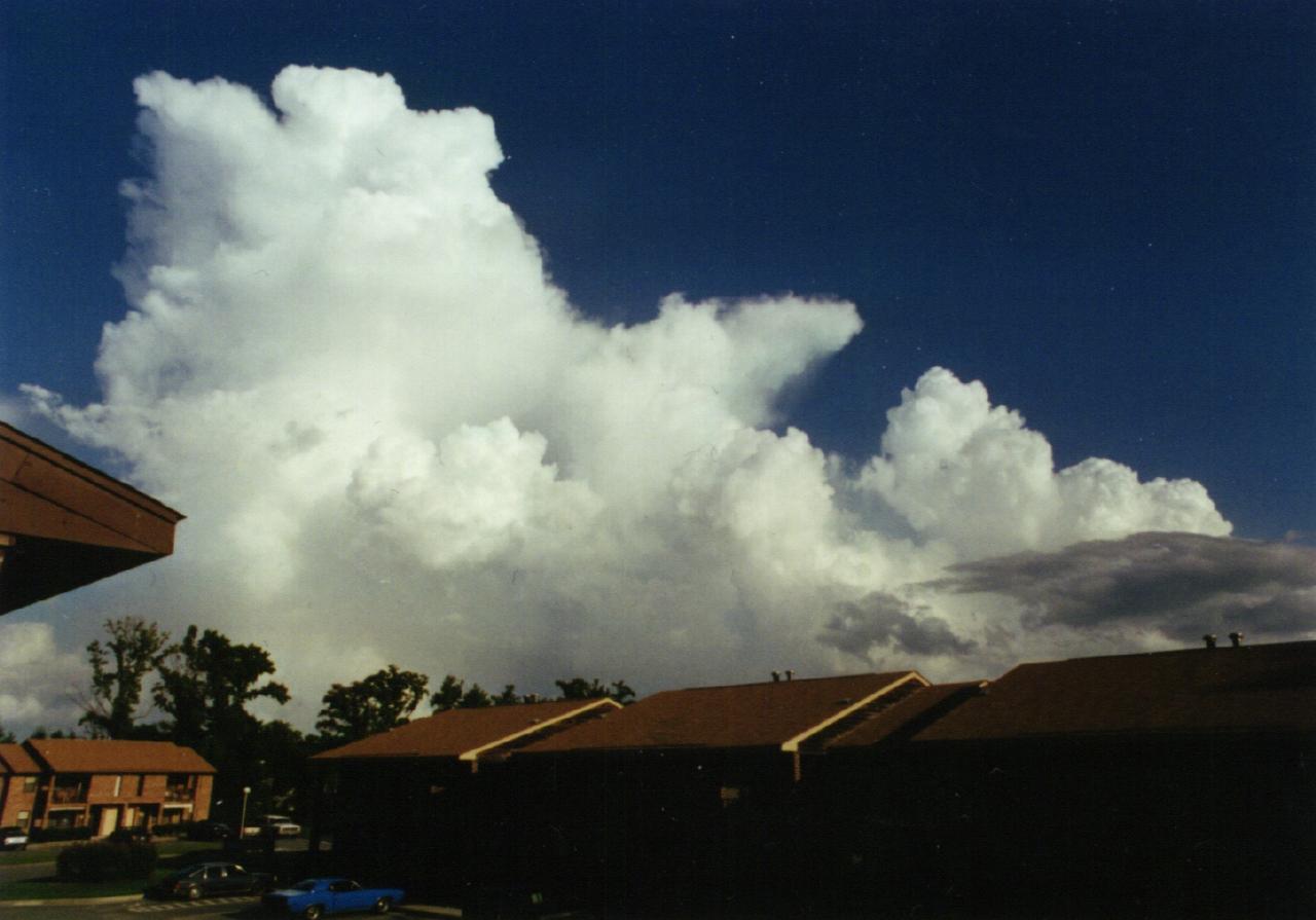
Developing Thunderstorm
This striking photograph shows the developing phase of a summer thunderstorm in New Jersey, USA. Note the very dark appearance of the base of the cloud, which is an indication of a very thick developing cumulus cloud. Also note the vivid interplay of sunlight at the cloud edges.
Photo by Rosemary Fields, of Hunterdon Christian Academy, Flemington, NJ, USA, in North Branch, NJ, August 2002.
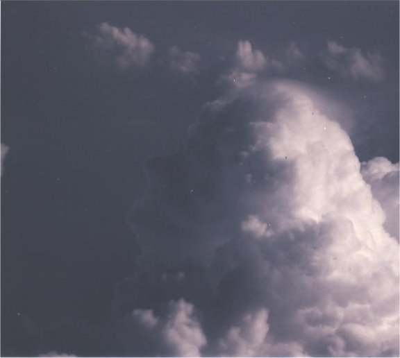
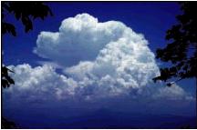
Top of Cumulonimbus
A good shot of a developing cumulus congestus cloud with some glaciation (cap cloud or pileus) starting to form at the top.
Photo from Forest Park High School, Woodbridge, Va. 1st place in April 2003 S'COOL cloud photo contest.
A good shot of a developing cumulus congestus cloud with some glaciation (cap cloud or pileus) starting to form at the top.
Photo from Forest Park High School, Woodbridge, Va. 1st place in April 2003 S'COOL cloud photo contest.
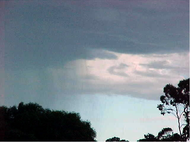
Cumulonimbus with Rain
An excellent picture clearly showing precipitation falling from a cloud. Capturing precipitation from a cloud in a photo is not always easy to do.
Photo from Mazenod College, Perth, Australia. 2nd place in April 2003 S'COOL cloud photo contest.
An excellent picture clearly showing precipitation falling from a cloud. Capturing precipitation from a cloud in a photo is not always easy to do.
Photo from Mazenod College, Perth, Australia. 2nd place in April 2003 S'COOL cloud photo contest.
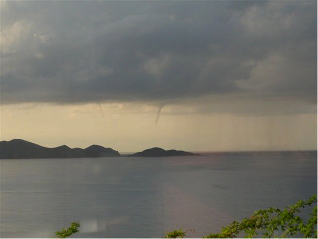
Cumulonimbus with Waterspouts
A striking picture of waterspouts, and rain too!
Photo from Cedar School, Cruz Bay, Virgin Islands. 3rd place (tie) in April 2003 S'COOL cloud photo contest.
A striking picture of waterspouts, and rain too!
Photo from Cedar School, Cruz Bay, Virgin Islands. 3rd place (tie) in April 2003 S'COOL cloud photo contest.
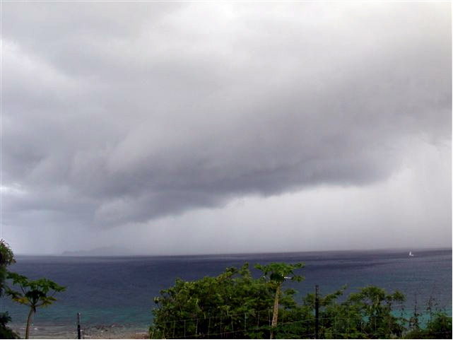
Cumulonimbus with Heavy Rain
Low hanging cloud under cumulonimbus. Heavy rain obscuring island. Good updraft (dark base).
Photo from Cedar School, Cruz Bay, Virgin Islands. 3rd place (tie) in April 2003 S'COOL cloud photo contest.
Low hanging cloud under cumulonimbus. Heavy rain obscuring island. Good updraft (dark base).
Photo from Cedar School, Cruz Bay, Virgin Islands. 3rd place (tie) in April 2003 S'COOL cloud photo contest.
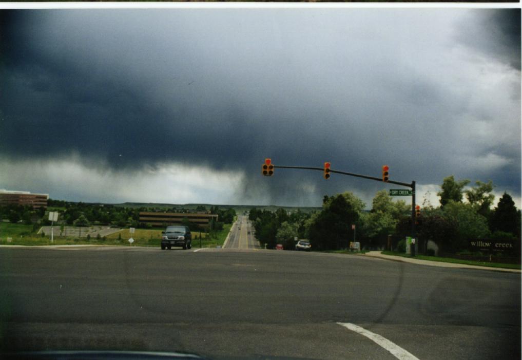
Under a Cumulonimbus Cloud
This is what it looks like underneath a cumulonimbus (thunderstorm) cloud. Notice the strong downdrafts indicating active convection and the very opaque cloud on the right of the picture.
Photo by Kevin Larman in Colorado.
This is what it looks like underneath a cumulonimbus (thunderstorm) cloud. Notice the strong downdrafts indicating active convection and the very opaque cloud on the right of the picture.
Photo by Kevin Larman in Colorado.
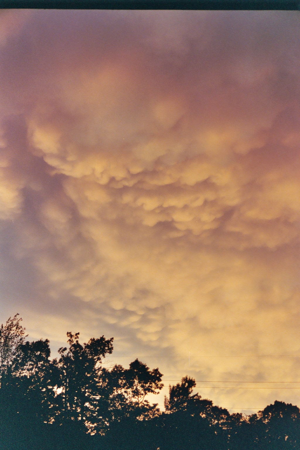
Under a Cumulonimbus Cloud - II
Another possible thing you can see beneath a cumulonimbus cloud is called mammatus. This is an indication of very active updrafts and downdrafts and can be a sign of severe weather. This particular photo was taken after a VERY intense thunder/ rain storm. Presumably there were more extensive and larger mammatus earlier, but it was pitch dark during the storm!
Photo by Laura Hinkelman in Connecticut.

Big Sky Cumulonimbus Cloud - I
During May, in years when El Niño is active in the Pacific, moisture flows across Northern Mexico and is lofted to great heights by heating over the Chihuahua Desert. This supercell sprang up just west of La Pryor, Texas, and was photographed by an observer on a bluff above the Rio Grande south of Quemado, Tx, some 40 miles away between 8 and 8:30 p.m. on the evening of May 7, 2012. The image on radar appeared to encompass an area some 100 miles wide from north to south.
Photo by Kay Cunninghan, a Texas rancher, May 2012.

Big Sky Cumulonimbus Cloud - II
A little later, as the sun set, the storm looks quite different. This kind of complete view of a thunderstorm cloud is typical of the US Great Plains - Big Sky country.
Photo by Kay Cunninghan, a Texas rancher, May 2012.
A little later, as the sun set, the storm looks quite different. This kind of complete view of a thunderstorm cloud is typical of the US Great Plains - Big Sky country.
Photo by Kay Cunninghan, a Texas rancher, May 2012.