S'COOL: Altocumulus Clouds
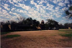
Altocumulus during Texas spring
Photo by Mandana Khaiyer, March 1997, in San Antonio, TX. This is a nice picture of altocumulus, showing a tendency to form cloud 'streets' (i.e., rows of cloud), which is an indicator that there is some wave phenomenon occurring in the atmosphere.
Photo by Mandana Khaiyer, March 1997, in San Antonio, TX. This is a nice picture of altocumulus, showing a tendency to form cloud 'streets' (i.e., rows of cloud), which is an indicator that there is some wave phenomenon occurring in the atmosphere.

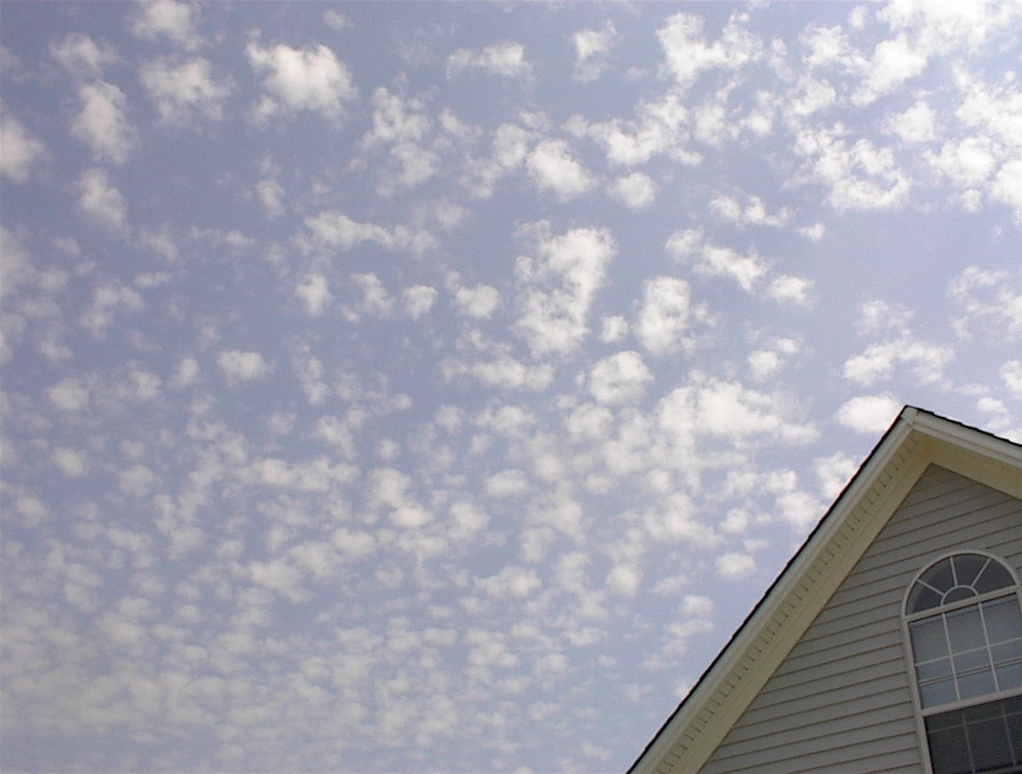
Altocumulus during Virginia Summer
Photo by Lin Chambers, August, 2002. Notice the very puffy, cottonball look of the clouds at the top of this image. Compare to cumulus and cirrocumulus photos to contras the apparent size of the cloud cells.
Photo by Lin Chambers, August, 2002. Notice the very puffy, cottonball look of the clouds at the top of this image. Compare to cumulus and cirrocumulus photos to contras the apparent size of the cloud cells.
Altocumulus during Virginia Summer
Photo by Lin Chambers, August, 2003. Hmmm... almost exactly a year after the image above, and a very similar cloud.
Photo by Lin Chambers, August, 2003. Hmmm... almost exactly a year after the image above, and a very similar cloud.

Edge of Altocumulus Field
Photo by Lin Chambers, August, 2003. This is the same day as the photo above. Note the very distinct edge to the Altocumulus cloud field. This is due to the fact that these clouds generally form along a front - the edge defines that front's location.
Photo by Lin Chambers, August, 2003. This is the same day as the photo above. Note the very distinct edge to the Altocumulus cloud field. This is due to the fact that these clouds generally form along a front - the edge defines that front's location.

Summertime Altocumulus
Photo by Jon Doughty, June 2007. Another nice example of summertime altocumulus in Virginia, again taken as the weather was changing in advance of a front. Note the thicker portion of the cloud at upper left. This cloud field was somewhat complex and challenging to identify. Determination of altocumulus was confirmed by looking at the cloud altitude and ceiling information on the Weather Underground website.
Photo by Jon Doughty, June 2007. Another nice example of summertime altocumulus in Virginia, again taken as the weather was changing in advance of a front. Note the thicker portion of the cloud at upper left. This cloud field was somewhat complex and challenging to identify. Determination of altocumulus was confirmed by looking at the cloud altitude and ceiling information on the Weather Underground website.